
 |

| Old NC-1A | ||||||||||
New NC-1A (1974-79) | to NC-3A | |||||||||
|
| |||||||||
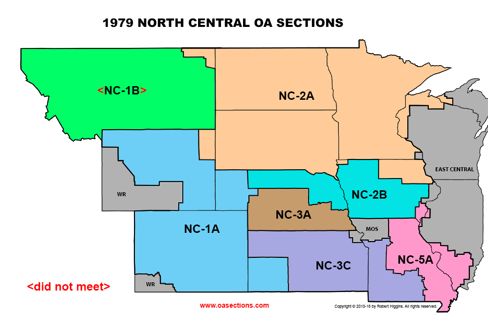
| NC-1B (1974-76) | ||||||
<did not meet 1977-79> | to NC-1A? | |||||
|
to NC-2B?
| |||||
| Tonkawampus 16 |
| Blue Ox 26 |
| Naguonabe 31 |
| 1975: Wahpekute 53 (nc) └ Midewiwin 53 |
| Timmeu 74 |
| Sac-N-Fox 108 |
| Mesabi 196 |
| Agaming 257 |
| Nahak 526 |
| 1977: Pa-Hin 27 |
| ├ Chan-O-Wapi 52 (from NC-2B in 1974) ├ Minniduta 176 (from NC-2B in 1974) ├ Chatoka 183 (from NC-2B in 1974) └ Thunderbird 371 (from NC-2B in 1974) |
| Tonkawampus 16 |
| Blue Ox 26 |
| Pa-Hin 27 |
| Naguonabe 31 |
| Wahpekute 53 |
| Timmeu 74 |
| Sac-N-Fox 108 |
| Mesabi 196 |
| Agaming 257 |
| Nahak 526 |
| Tetonwana 105 (from NC-2B) |
| Crazy Horse 171 (from NC-2B?) |
| Old NC-2B | |||||||||||||
New NC-2B (1974-78) | to NC-2A | ||||||||||||
|
| ||||||||||||
| Old NC-2B | ||||||||
New NC-2B | to NC-2A | |||||||
|
| |||||||
| Old NC-3A | |||||||||
New NC-3A (1974-79) | to NC-2B | ||||||||
|
| ||||||||
| Shawnee 51 |
| Silver Tomahawk 80 |
| Taleka 81 |
| Black Hawk 94 |
| Anpetu-we 100 |
| Cahokia 126 |
| Nampa-Tsi 216 |
| Ney-A-Ti 240 |
| Osage 42 |
| Nik-Ka-Ga-Hah 91 |
| Tamegonit 147 |
| Nani-Ba-Zhu 321 |
| Dzie-Hauk Tonga 429 |
| Kidi Kidish 434 |
| Hi-Cha-Ko-Lo 458 |
 Union County, South Dakota: 1978 is the earliest map source to show Union Co. as part of Prairie Gold Area Cncl. However, it may have always been part of this council, as this is on the south-east border of the state it is possible that this detail was glossed over in earlier maps. This county was also supposedly part of Sioux Council, as late as 1997, which may represent an overlap.
|
OA Section List This page updated: webmaster@oasections.com |
OASections.com |
¤ | ¤ |
|
 |
Copyright © 2006-24 by Robert Higgins. All rights reserved. |
